Tech Talk with Jonathan Keeny, GPS Manager at Barnhill
Technology is an important tool in the Barnhill toolbox. It is critical to the work we do and helps increase precision on the job. Many are unaware of how GPS technology is used in our Civil Group, so we had a sit down with Jonathan Keeny, GPS Manager. “It is standard for us to call this technology “GPS” (Global Positioning System) because that was the original system, but now in the equipment world you will actually see it as GNSS (Global Navigation Satellite System), which is a generic, umbrella term for multiple systems. GPS is the American system of GNSS, and one of the many used across the globe,” said Jonathan. Barnhill’s newer equipment now also incorporates the Chinese system, BeiDOU, the European system, GALILEO and the Russian system, “GLONASS.”. The more satellites you have, the more coverage you have and better accuracy on the ground. “With access to multiple systems, we could still get good coverage, for example, in the woods,” said Jonathan. “Back when all we had access to was the American System, GPS, you had to schedule your surveying observations around when those 8 – 10 satellites would be visible in the sky. You would have to work at night and sit out there for hours to track just a few satellites. Now, we are even better than we were then.”
All grading equipment that uses this technology has a receiver on top that looks like a square antenna, which receives transmissions from the satellites. Similar to your phone’s access to the GPS signal, it is accurate within about a foot or two. To get the accuracy that we need for construction, we incorporate a second receiver (a base station) that remains stationary. The Superintendent sets up this base station on the job site. The base station knows its static position relative to all those satellites, while the receiver on the equipment is in motion. It then sends corrections to the equipment’s receiver, essentially telling it, “hey, I know where I’m at, this is what the satellites are telling me, and here are the corrections the equipment operator needs to make to grade more precisely.” Operators have a screen inside the equipment where they can read these measurements and corrections, adding to their own innate abilities. All screens are customizable, and the operator can set it to see what is most important for their situation, such as coordinates and elevation or cut and fill based on their surface. It computes the horizontal and vertical location of the blade that cutting is performed with, such as the blade of the bulldozer or the bucket of the excavator.
“This technology has truly revolutionized how we do grading,” said Jonathan. Before, the surveyor would set stakes on a grid with a mark where the dirt should go. You would have to know how to read the stake, have someone helping you with a level, and it took much longer. Now, in real-time, GPS keeps track of where you are on the site, tells you how much above the surface you are and how much dirt to cut off. A feature called vertical off-set can also be set. For instance, let’s say the team needs to cut down to sub-grade to be able to put stone on top of that and then asphalt on top of the stone. So, the operator would put in 7 inches below the asphalt grade and the system would tell them to come up an inch or down an inch. The equipment also has automatic control now that does this for the operator so they don’t have to manually manage the blade so much. They can simply drive across the site and the blade will adjust as they go. There is a switch for the automatic mode, but you do have to manually be pretty close to begin with before turning this switch on. The automatic mode will then smooth the final couple of inches to finish it off. All this to say that we DO still teach the “old-school” way of doing this in our Walter Brown Equipment Training Program, because it’s important for operators to understand the full scope of the work. But this technology takes us to a whole other level when it comes to quality and speed. “That level of accuracy on the GPS allows us to do this,” says Jonathan.
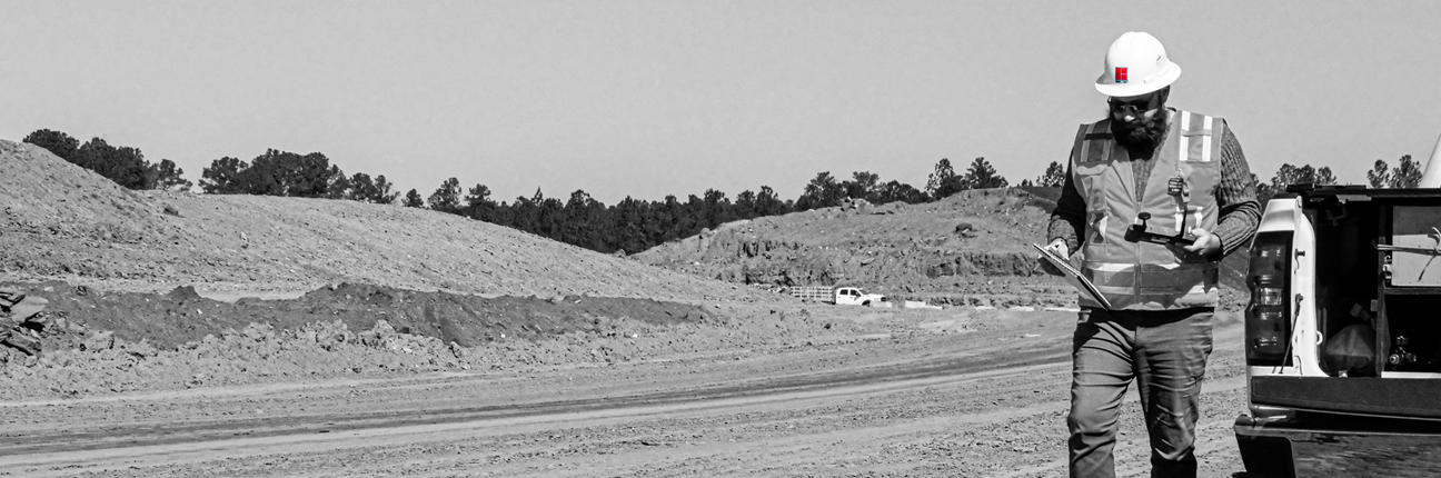
Grade Foremen also use a rover (a GPS receiver on a rod) to double check the accuracy of the operator and GPS technology on the equipment. They carry a tablet that has the same information the equipment has and can walk behind the equipment with the rover to confirm everything is right or determine if something is off. They can also use this to plan ahead for where a crew needs to be working at that day within a designated area.
This system is also used for drone surveys, flying in a pattern back and forth across the site. A multitude of photographs are taken that are then stitched together with a software. Each photo has GPS coordinates and elevation associated with it. We can do a ground topography from the photographs, saving us days of having to collect ground points with survey equipment. Most of the time, we use this for tracking progress such as how much dirt has been moved, how much dirt needs to be brought in, how close we are to being finished, determining volumes of stockpiles, and tracking inventory of material piles at the asphalt plants. Also, whenever we have recycled shingles that need to be crushed at the plants, a subcontractor will do this for us. We then perform a drone flight of the crushed material pile and that is how we pay the subcontractor, based on the calculated volume from the GPS in the drone.
GPS can also be used, paired with the work of a surveyor, for curb and gutter or laying out roads. The GPS serves as the last final check for accuracy such as the final centimeter of dirt, getting stone compacted just right, or ensuring the asphalt ties in just as it is intended in the plans. For final paving, a laser emitter can be used in conjunction with the GPS for a tighter accuracy.
Our GPS program is building a major sense of innovation within Barnhill. A big thanks goes out to Jonathan Keeny for his commitment and expertise to ensure this program flourishes, as well as to Matt Murdock, GPS Foreman, who is a master of troubleshooting GPS issues with the equipment specifically. He serves as the “on-the-ground” support for GPS in the field. Between Jonathan and Matt, they are constantly grinding and doing everything they can for our crews and our projects. This program will only continue to grow, and we are thankful for their dedication.